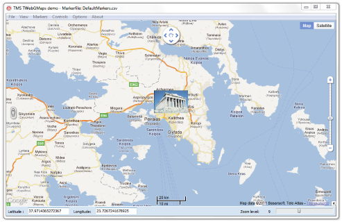
TMS TWebGMaps
| Infocard
| ||||||||||||||||
| ||||||||||||||||
Integrates Google Maps in VCL apps
|
| 4.54 Mb |
Contents
Description by the Publisher
VCL Component with extensive configurability for integrating Google Maps in VCL applications:
- Different map modes are available: default road map, satellite view, hybrid view and terrain
- Extra map information can be displayed: Bicycle View, Panoramio (pictures of interest) information, Traffic information
- StreetView can be selected
- Position markers may be added to the maps, including default Google balloon markers and custom image markers.
- Moving over a marker can display a hint with the marker title information
- Extensive configuration options over the different Google maps controls are available: MapType control, OverViewMap control, Pan control, Scale control, StreetView control and Zoom control.
- Image files can be created of the displayed map. Images can be saved in different formats: .BMP, .JPG or .PNG
- Different mouse and keyboard options to enable/disable: mouse or keyboard panning, mouse or keyboard zoom, mouse wheel scrolling
- TWebGMapsGeocoding helper component to facilitate conversions between address and longitude/latitude coordinates
Limitations in the Downloadable Version
No limitations
Product Identity
Unique Product ID: PID-5000E7BC43C2
Unique Publisher ID: BID-44009E1B338D
