OkMap Desktop
| Infocard
| ||||||||||||||||
| ||||||||||||||||
OkMap - GPS and map software for Windows
|
| 145.22 Mb |
Contents
Description by the Publisher
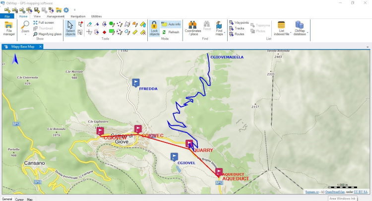
OkMap is a GPS and map software that:
-Works with vectorial maps and calibrates raster maps
-Organizes paths by creating waypoints, routes and tracks
-Uploads/downloads data to/from your GPS
-Uses altitude DEM data
-Supports GPS real-time navigation
-Sends/receives vehicles position and display tracks on maps in real time
-Provides autorouting and geocoding functions
-Supports integration with Google Maps/Earth (in 3D also)
Potential use:
-Search and rescue
-Trekking
-Off road
-Boating
-Flying
-Mountain bike
-Geocaching
-Hunting and fishing
-Finding mushrooms
-Soft air
Main features:
-Calibrate raster maps with different cartographic projections
-Create own digital maps importing / drawing shapes
-Create and manage waypoints, routes and tracks in GPX format
-Download, save and automatically georeference maps from Google Maps
-Support autorouting, geocoding and inverse geocoding functions
-Use digital terrain models to store and display elevation
-Upload / download data to / from GPS devices
-Navigate in real time through NMEA protocol
-Map tiling for handheld GPS
-Display Google Earth and Google Maps in current map location
-Exchange data with Google Earth and view your map in 3D
-Find nearby cache in www.geocaching.com
-Exchange data with gpsgate.com server
-Receive navigation data from remote GPS devices
-Send the current position to an OkMap remote server
-Make conversions between coordinates, datums, formats, ...
Supported formats:
-Images: ECW, BMP, GIF, JPG, PNG, TIF e molti altre
-Maps: file world; ECW, GeoTiff, KML/KMZ, JNX, OziExplorer, CompeGPS, GPSTrackMaker, RMap, MBTiles, OruxMaps, GpsTuner
-Map Tiling: KML, KMZ, JNX, OruxMaps, TomTom
-Vector data: SHP, DCW
-GPS data: GPX, CompeGPS, EasyGPS, Fugawi, Garmin, Geocaching, Google Earth, GPS TrackMaker, OpenStreetMap, OziExplorer , ...
-DEM data: HGT (SRTM-1 and SRTM-3)
Limitations in the Downloadable Version
The maximum zoom value for web maps is limited to 12. ECW maps cannot be opened. Map georeferencing is limited to two points. GPX data cannot be saved. Download DEM data is not included. Map tiling is not included. The calculation of travel time ....
Product Identity
Unique Product ID: PID-37008C9B1671
Unique Publisher ID: BID-27008C9B1671
