NTv2Tools
| Infocard
| ||||||||||||||||
| ||||||||||||||||
NTv2Tools is a Toolbox for NTv2 files
|
| 8.90 Mb |
Contents
Description by the Publisher
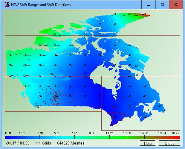
NTv2Tools Geosoftware provides a toolbox for developing and processing of NTv2 files in binary and ASCII formats. With the included tools NTv2 files can be analyzed and graphically or textual displayed, they can be converted to other file formats and areas of them can be extracted to new NTv2 files. By means of NTv2 grid files it is possible to transform points from one coordinate reference system to another with very high accuracy. An NTv2 file contains one or more quasi-rectangular coordinate grids which are defined in the NTv2 headers. The program NTv2Tools provides digital tools for developing and processing NTv2 files in binary and ASCII formats. The program analyzes NTv2 files and outputs detailed information on the screen, in graphics files and in text files. The program allows conversions between the binary and ASCII formatted variants of the NTv2 files. Furthermore, areas can be extracted from NTv2 files and swapped out to new NTv2 files. This resolves the known issues with oversized NTv2 files. In the future, also new NTv2 grids can be added to existing NTv2 files. With the program NTv2Tools in detail the following processings are possible: Analyze NTv2 file; Display NTv2 grids and subgrids; Display NTv2 activity scopes (normal and polygonal); Convert NTv2 ASCII file to NTv2 Binary file; Convert NTv2 Binary file to NTv2 ASCII file; Extract an area from a NTv2 file. NTv2 files that have been previously equipped with Polygonal Validity Scopes to map a polygonal boundary instead of a quasi-rectangular area in the NTv2 grids are supported by the NTv2Tools program. The Polygonal Validity Scopes realized in the NTv2 files is graphically displayed during the analysis. The program has a user-selectable multi language interface and comes with extensive online help. The program can be run on most common networks and it is possible to use Terminal Services on WINDOWS Servers. In case of a network installation the clients are installed automatically by the program.
Limitations in the Downloadable Version
Full functionality with presetted NTv2 files
Product Identity
Unique Product ID: PID-0200C729B92A
Unique Publisher ID: BID-A500D33FDCC0
