NOV Diagram for .NET
| Infocard
| ||||||||||||||||
| ||||||||||||||||
Advanced diagram component for .NET
|
| 184.56 Mb |
Contents
Description by the Publisher
NOV Diagram for .NET is built upon the NOV Document Object Model (DOM) and is a scalable and extensible solution. It has been carefully designed to meet a vast amount of customization requests. The object model and the API had been thoroughly refined to be as native and intuitive as possible.
NOV Diagram for .NET features:
Drawings: Drawings are constructed by multiple pages each of which has multiple shapes. Thus diagrams are basically created by creating shapes inside drawing pages.
Libraries: Libraries help you organize drawing clippings into stencils. Thus libraries are basically created by creating library items that can contain single or multiple shapes.
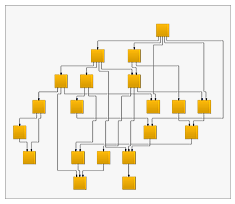
Automatic Layouts: The automatic arrangement of diagrams is an indispensable feature, especially when diagrams are either too large or are automatically generated. NOV Diagram for .NET comes equipped with a sophisticated set of automatic layouts.
Predefined Shapes: NOV Diagram for .NET comes equipped with numerous predefined shapes, which can come handy in many applications, including 18 Basic Shapes, 10 Connector Shapes and 31 Flowcharting Shapes.
Box Layouts:
- Stack Layout;
- Dock Layout;
Graph Layouts:
- Barycenter Graph Layout;
- Layered Graph Layout;
- Orthogonal Graph Layout;
- Radial Graph Layout;
- Single Cycle Graph Layout;
- Spring Graph Layout;
- Symmetrical Graph Layout;
Tree Layouts:
- Balloon Tree Layout;
- Compact Depth Tree Layout;
- Layered Tree Layout;
- Tip Over Tree Layout;
NOV Maps for .NET (Winforms, WPF, Silverlight, Mac OS)
NOV Diagram for .NET makes it easy to import geographical data from ERSI shapefiles. You can control the way the shapes are rendered by applying various fill rules to them. You can also specify a map projection to be used for transforming the 3D geographical data to a 2D screen coordinates.
Limitations in the Downloadable Version
Watermark on 60 days trial version
Product Identity
Unique Product ID: PID-3400161C4257
Unique Publisher ID: BID-1500EE4CAAB4
[NOV Diagram for .NET PAD XML File]
